Report 162 By W. M. Sandeen, U. S. Geological Survey | November 1972, (reprinted January 1983)
- Report 162 - Ground-Water Resources of Washington County, Texas
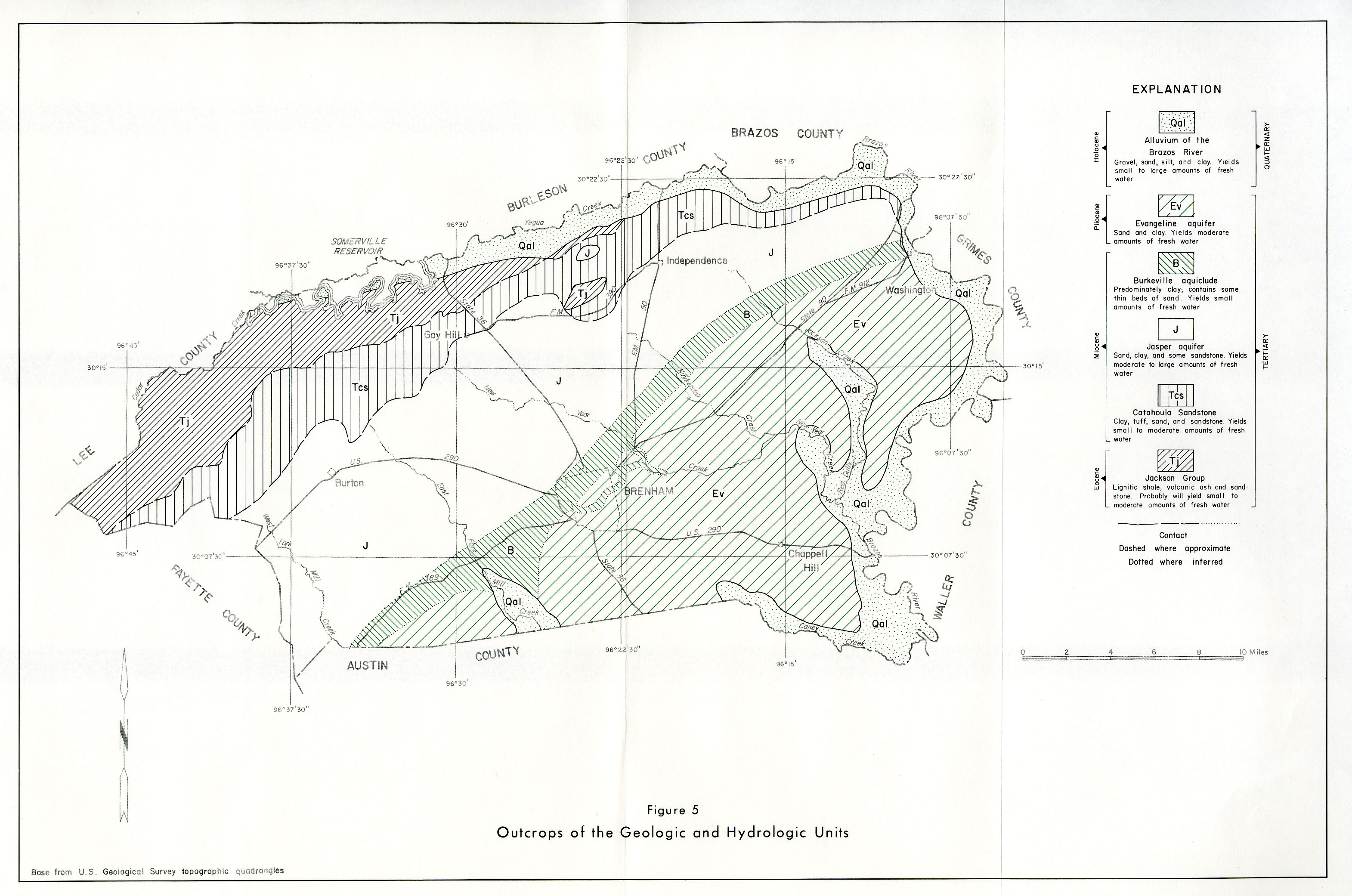
- Figure 5: Outcrops of Geologis and Hydrologic Units
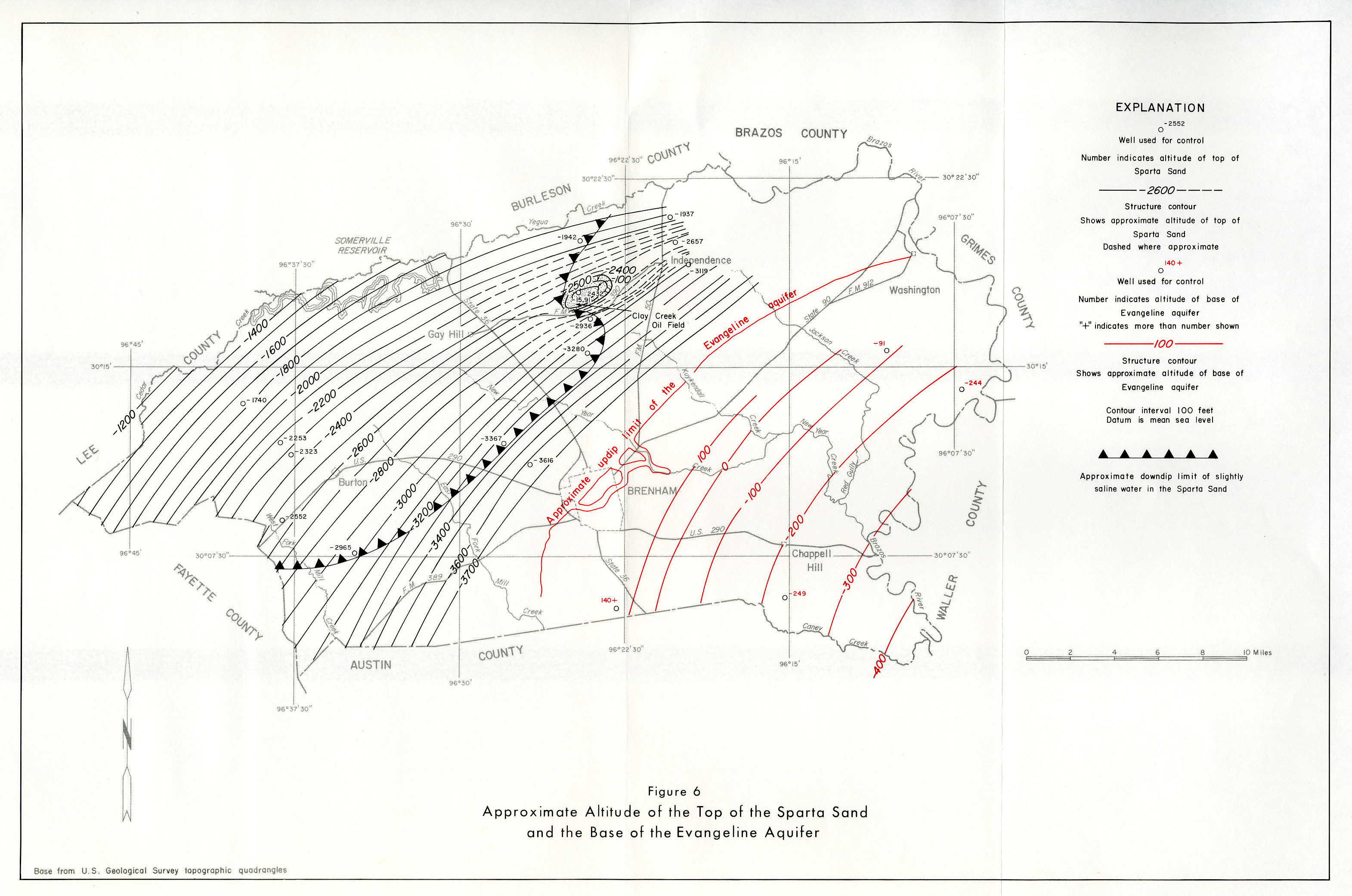
- Figure 6: Approximate Altitude of the Top of the Sparta Sand and the Base of the Evangeline Aquifer
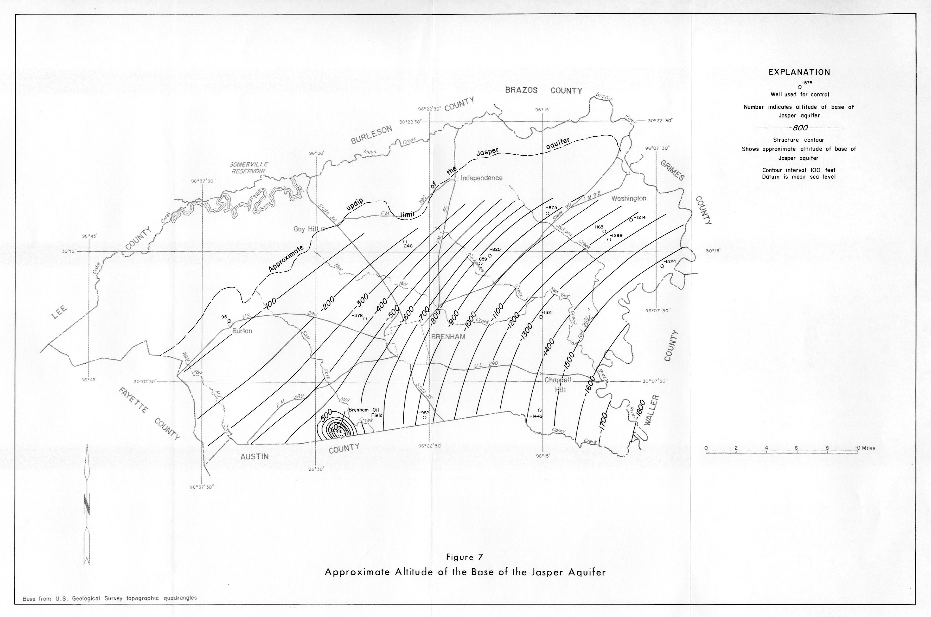
- Figure 7: Approximate Altitude of the Base of the Jasper Aquifer
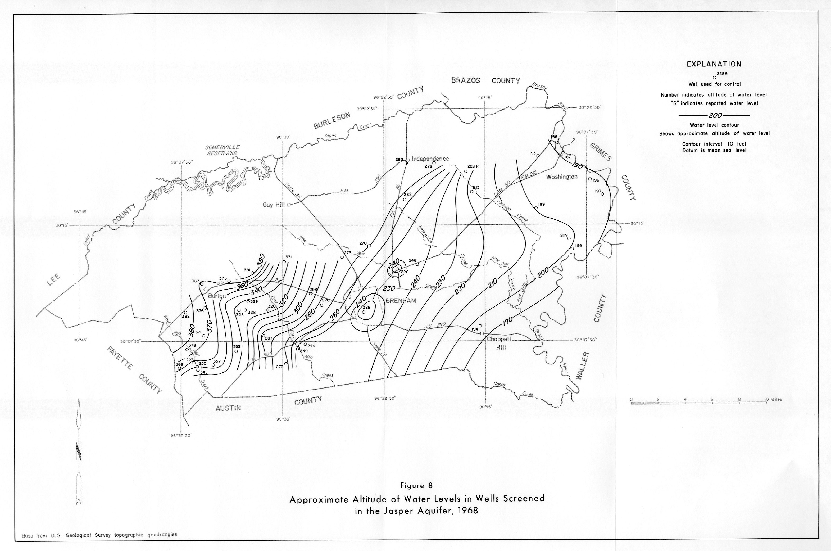
- Figure 8: Approximate Altitude of Water Levels in Wells Screened in the Jasper Aquifer, 1968
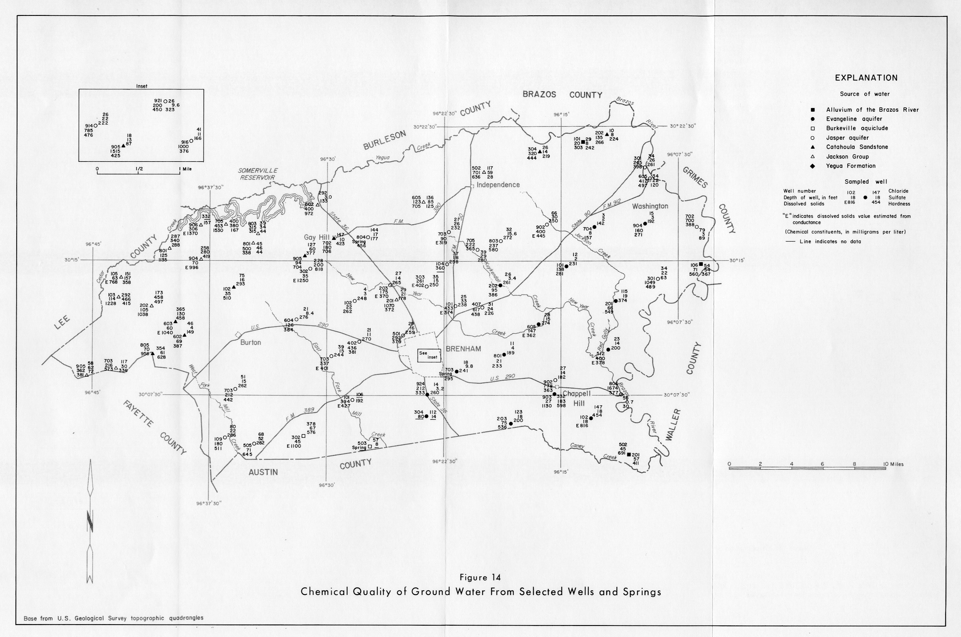
- Figure 14: Chemical Quality of Ground Water From Selected Wells and Springs
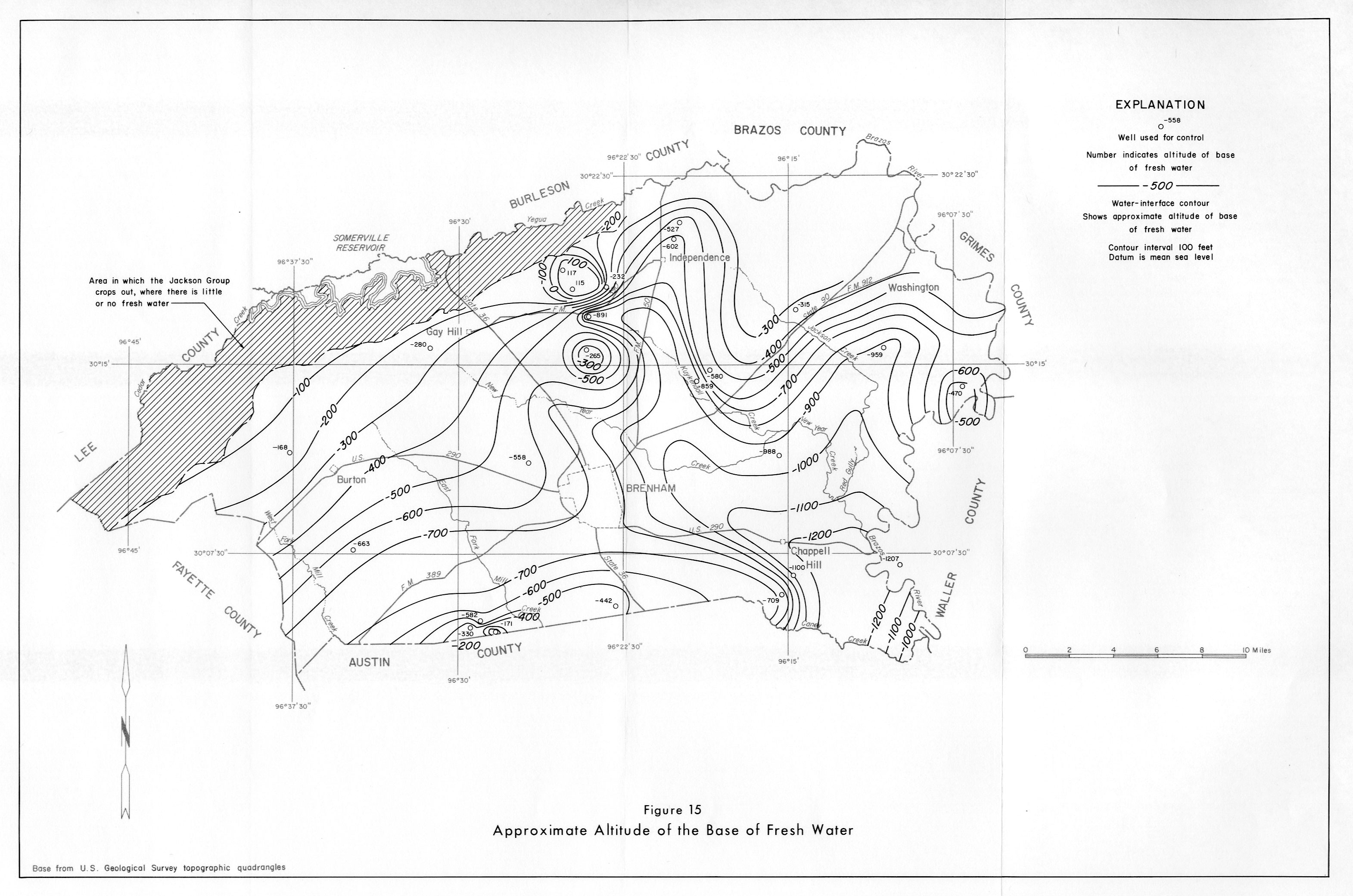
- Figure 15: Approximate Altitude of the Base of Fresh Water
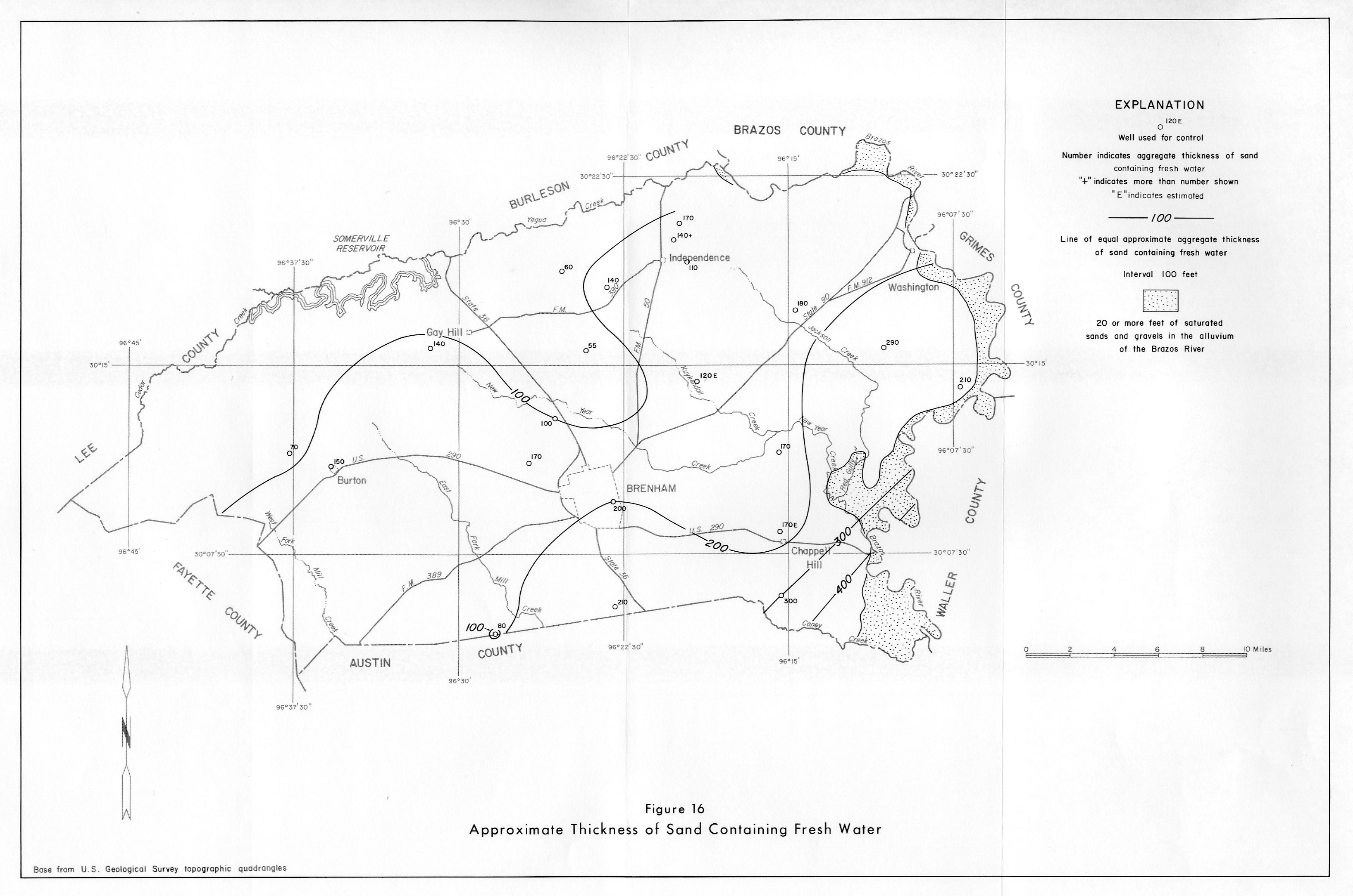
- Figure 16: Approximate Thickness of Sand Containing Fresh Water
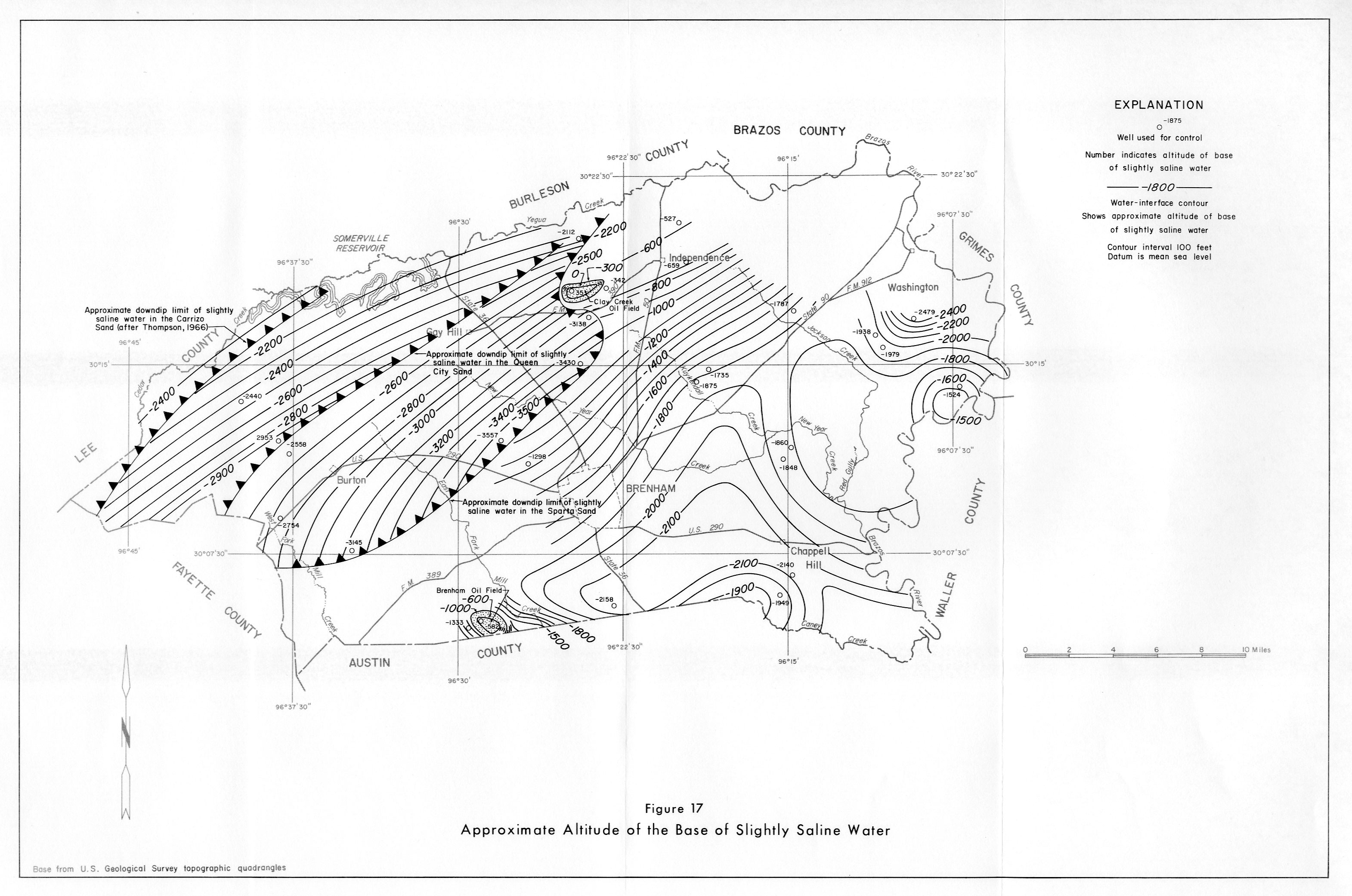
- Figure 17: Approximate Altitude of the Base of Slightly Saline Water
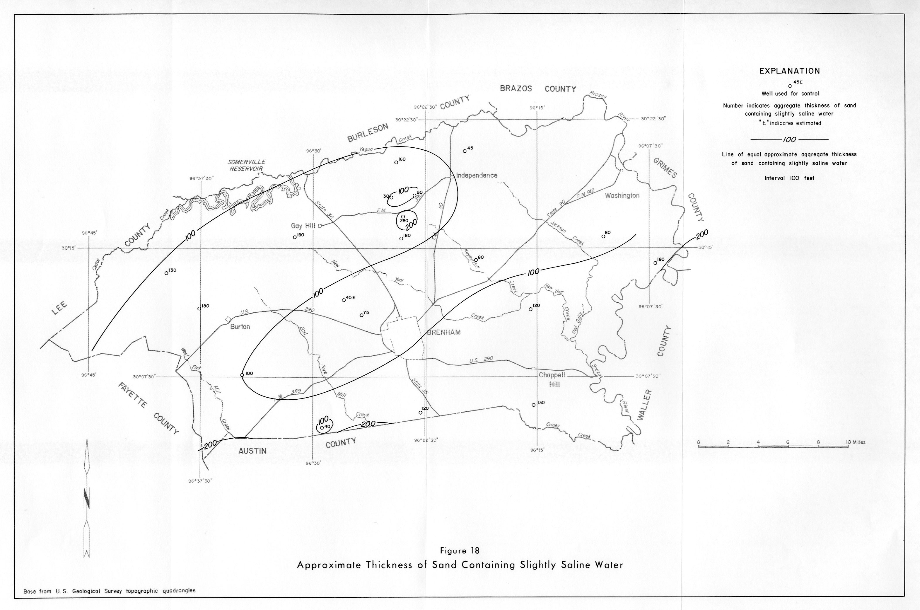
- Figure 18: Approximate Thickness of Sand Containing Slightly Saline Water
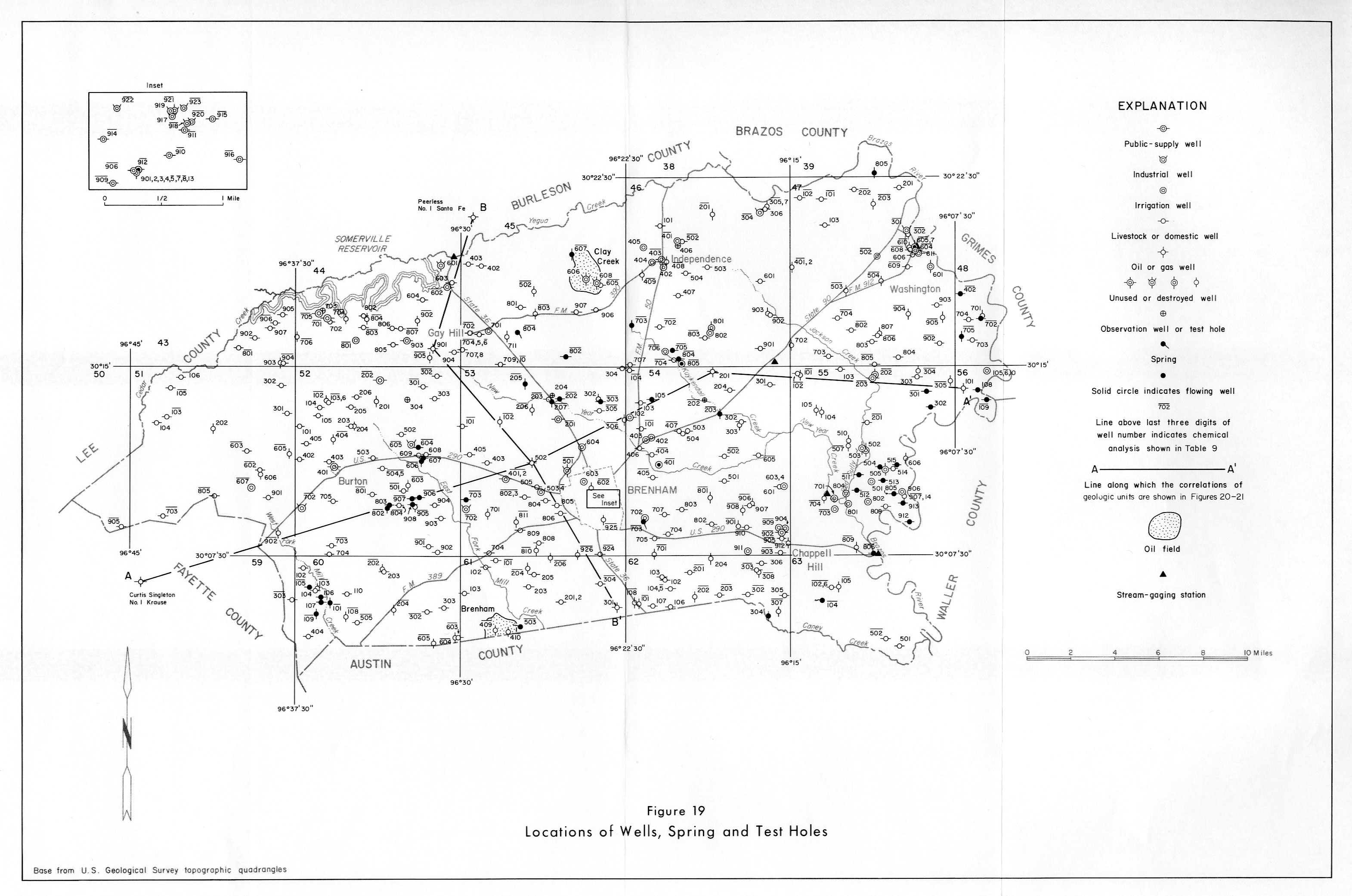
- Figure 19: Locations of Wells, Spring and Test Holes
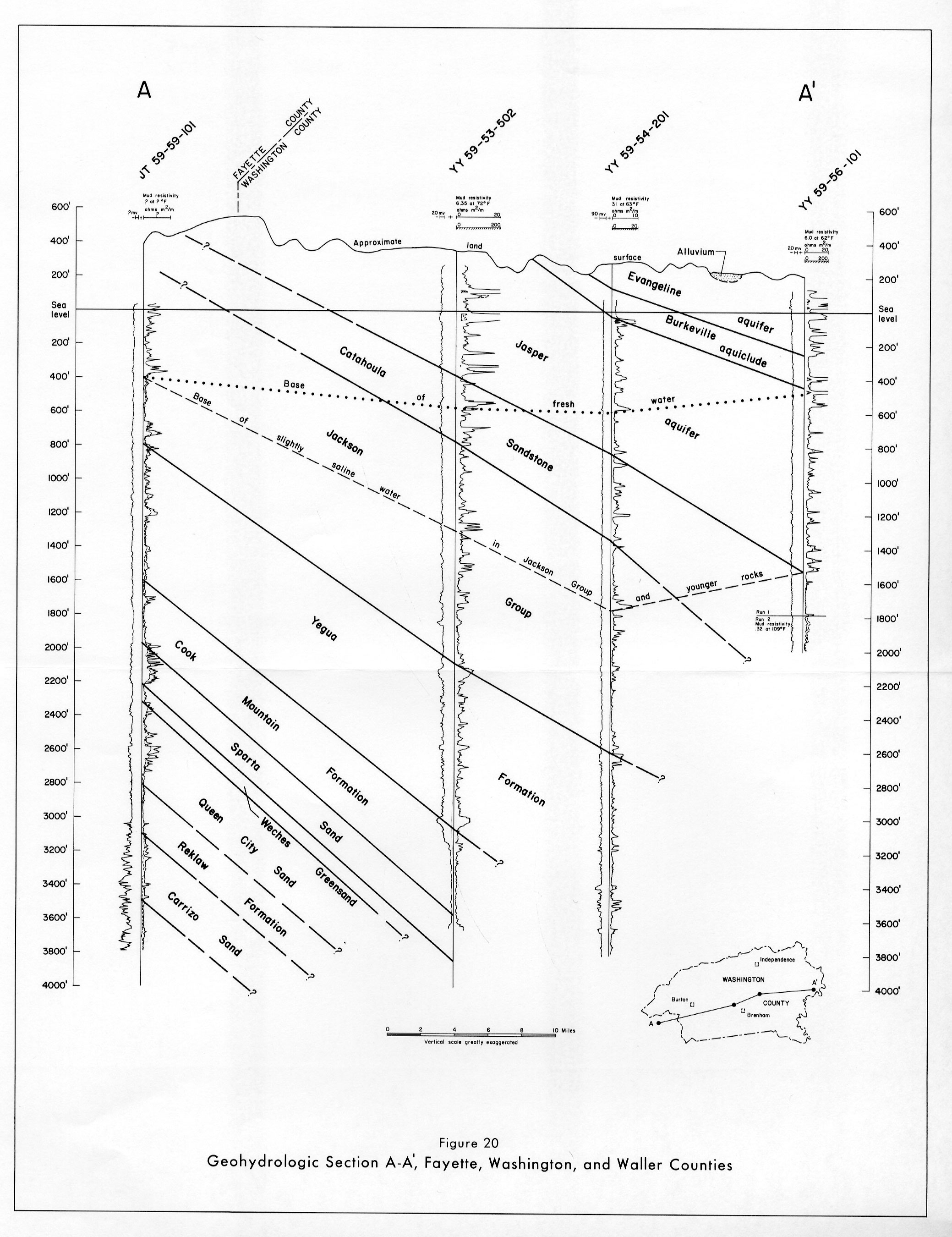
- Figure 20: Geohydrologic Section A-A', Fayette, Washington, and Waller Counties
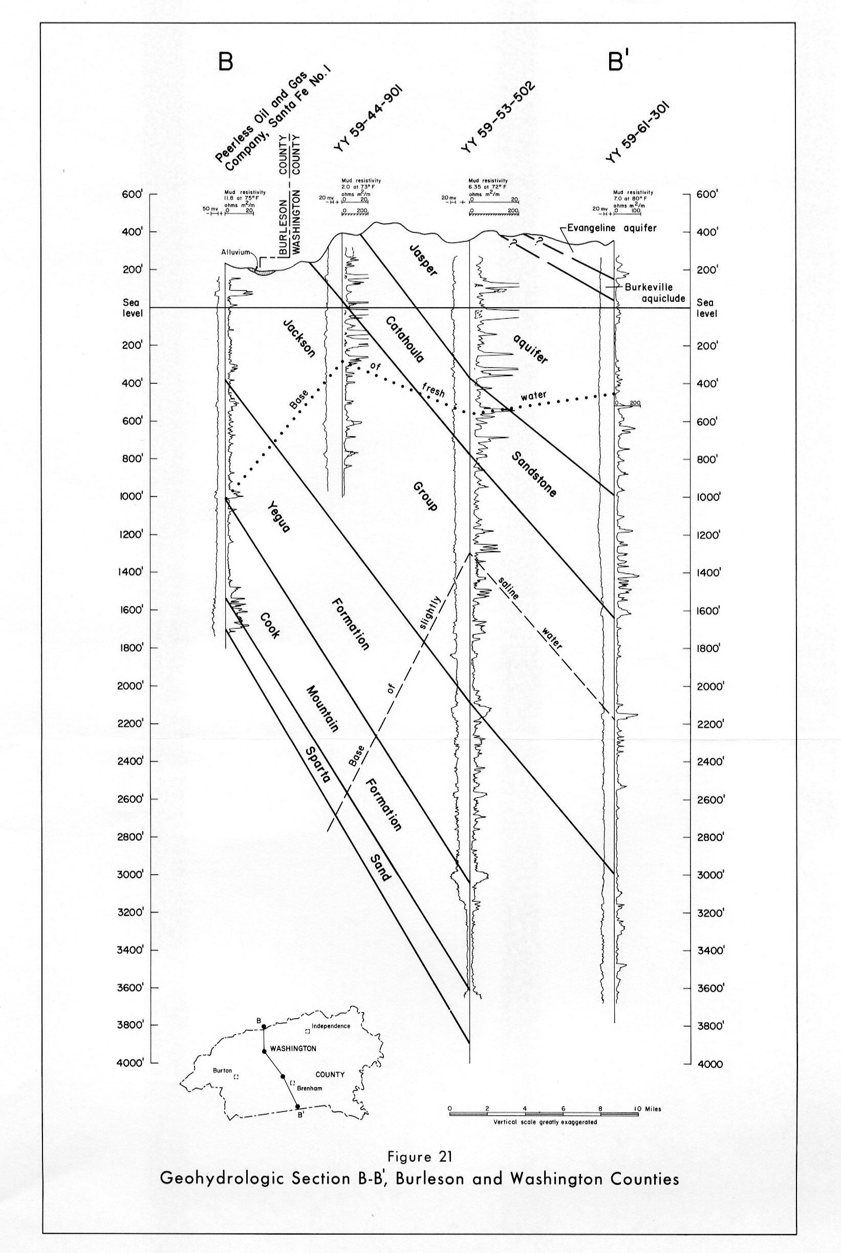
- Figure 21: Geohydrologic Section B-B', Burleson and Washington Counties