GIS Data
All GIS datasets are available for download in shapefile format. All datasets are in decimal degrees NAD 83. Please click a data category below to open or right click to save the datasets to your desktop. All shapefiles are zipped.
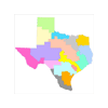
Natural Features
The GIS datasets listed below are related to various types of natural features. Although TWDB utilizes this data in our most commonly used maps, some of the datasets were created and are maintained by other state and federal agencies.
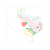
Major Aquifers - The 9 major aquifers of Texas as defined by the TWDB, Updated December 2006.
Minor Aquifers - The 22 minor aquifers of Texas as defined by the TWDB, Updated December 2017.
Major River Basins - The 23 major U.S.G.S. river basins of Texas, * These are not the 'official' TWDB basin boundaries.

Hydrologic Unit Code - HUC - Based on the USGS national hydrologic 8-digit coding system. Technically considered 'sub-basins'. Data current as of 2014.
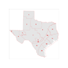
Existing Reservoirs - Existing reservoir boundaries reflecting the 2012 State Water Plan, Updated November 2014.
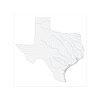
Texas Precipitation - Average monthly and annual precipitation for the climatological period 1981-2010. Data is from NRCS.
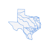
Major Rivers - Data extracted from NHD, 1:100,000 layer, Oct. 2009
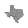
Texas Hillshade - Background image used in statewide maps, Generated from DEMs.
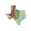
Texas Terrain Color Ramp - Texas hillshade raster plus color ramp.
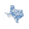
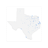
Well Locations from TWDB Groundwater Database (GWDB) - Updated nightly.

Well Locations from TWDB Submitted Driller's Reports Database (SDRDB) - Updated nightly
SDRDB Well Location Shapefile
SDRDB Plugging Report Shapefile
Administrative Boundaries
Boundaries for various administrative units including: Regional Water Planning Areas and Groundwater Conservation Districts are approximate and may not accurately depict legal descriptions.
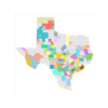
Groundwater Conservation Districts - Groundwater conservation districts in Texas. Source data is from TCEQ. Dataset current as of November 2019.
River Authorities and Special Law Districts - Statutory boundaries (but not necessarily the service areas). Data current as of 2014.
Groundwater Management Areas - GMAs - Groundwater Managment Area boundaries, approved May 2021.

Priority Groundwater Management Areas - PGMA - Updated Oct. 2009, as designated by TCEQ.
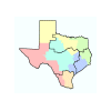
PFCA Regions and Field Office - Geographic area assignments for Regional Project Teams and Inspection & Field Support Services Offices.
Regional Water Planning Areas - The 16 Water Planning Regions in Texas, as created by TWDB, updated November 2014.

Flood Planning Regions - The 15 Flood Planning Regions in Texas, as created by TWDB, updated April 2020.
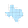
TWDB Well Location Grid
Texas Water Data Hub

Don't see what you're looking for? Try the new Texas Water Data Hub (beta) and search for a dataset.
BRACS program data
Webpage with TWDB Brackish Resources Aquifer Characterization System (BRACS) database GIS files – Includes zipped shapefiles of BRACS well locations, geophysical log locations, stratigraphic and lithologic interpretations, and measured and calculated water quality. Updated quarterly.