Report 80 by W.M. Sandeen, U.S. Geological Survey | August 1968
Note: the oversized fold out maps and figures below were scanned separately from the body of the report above, so "missing pages" are these figures.
- Report 80 - Ground-Water Resources in San Jacinto County, Texas
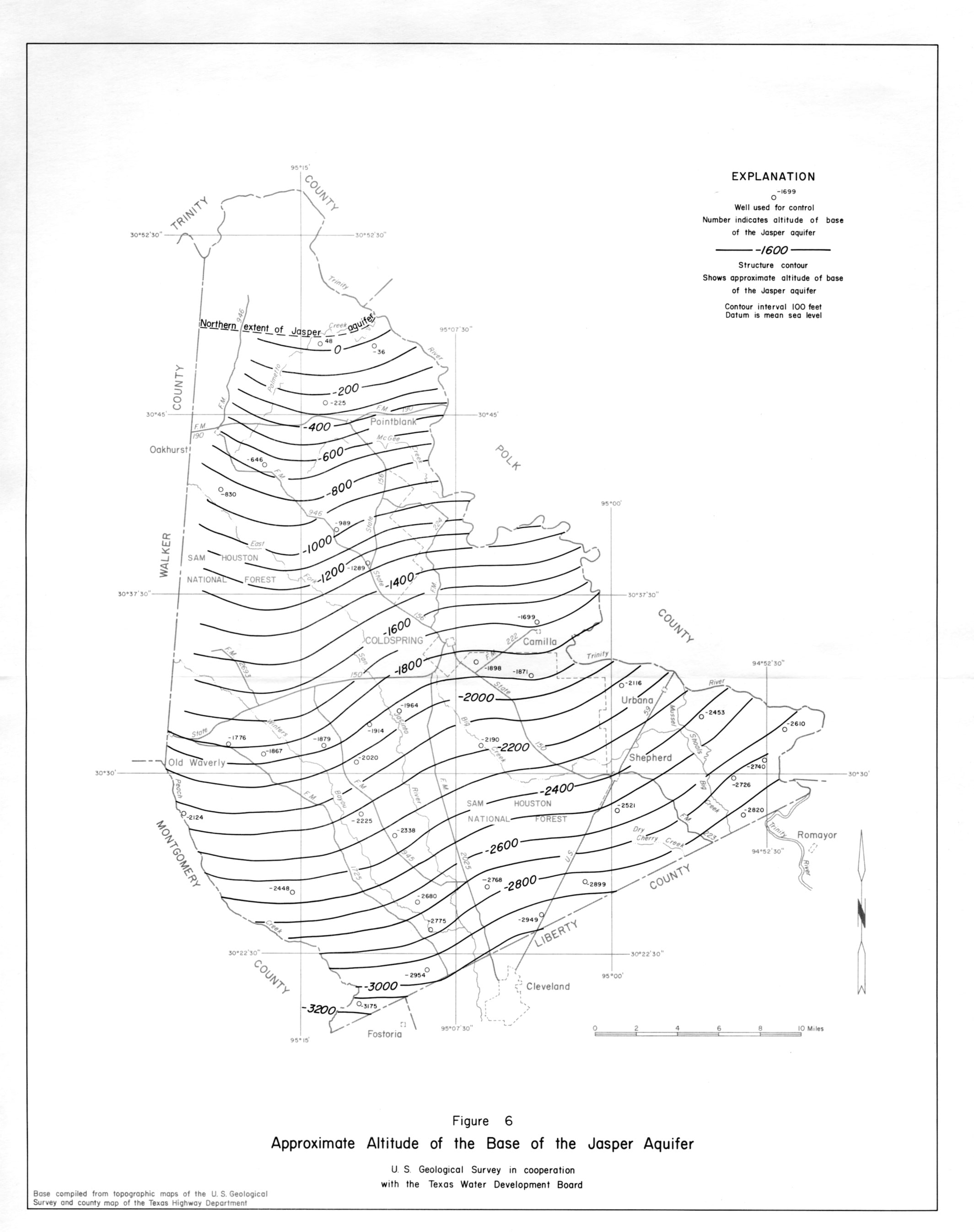
- figure 6 - Approximate Altitude of the Base of the Jasper Aquifer
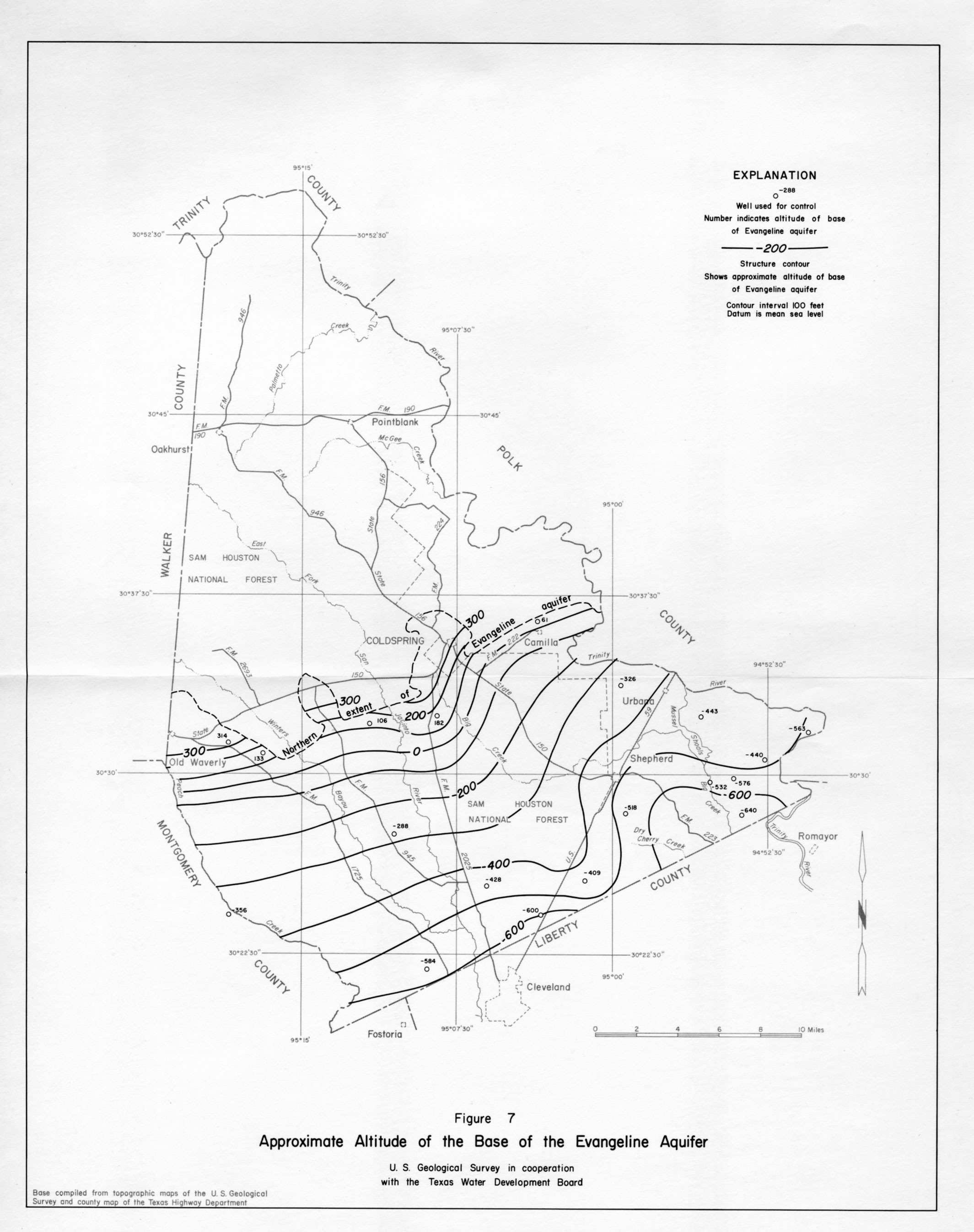
- figure 7 - Approximate Altitude of the Base of the Evangeline Aquifer
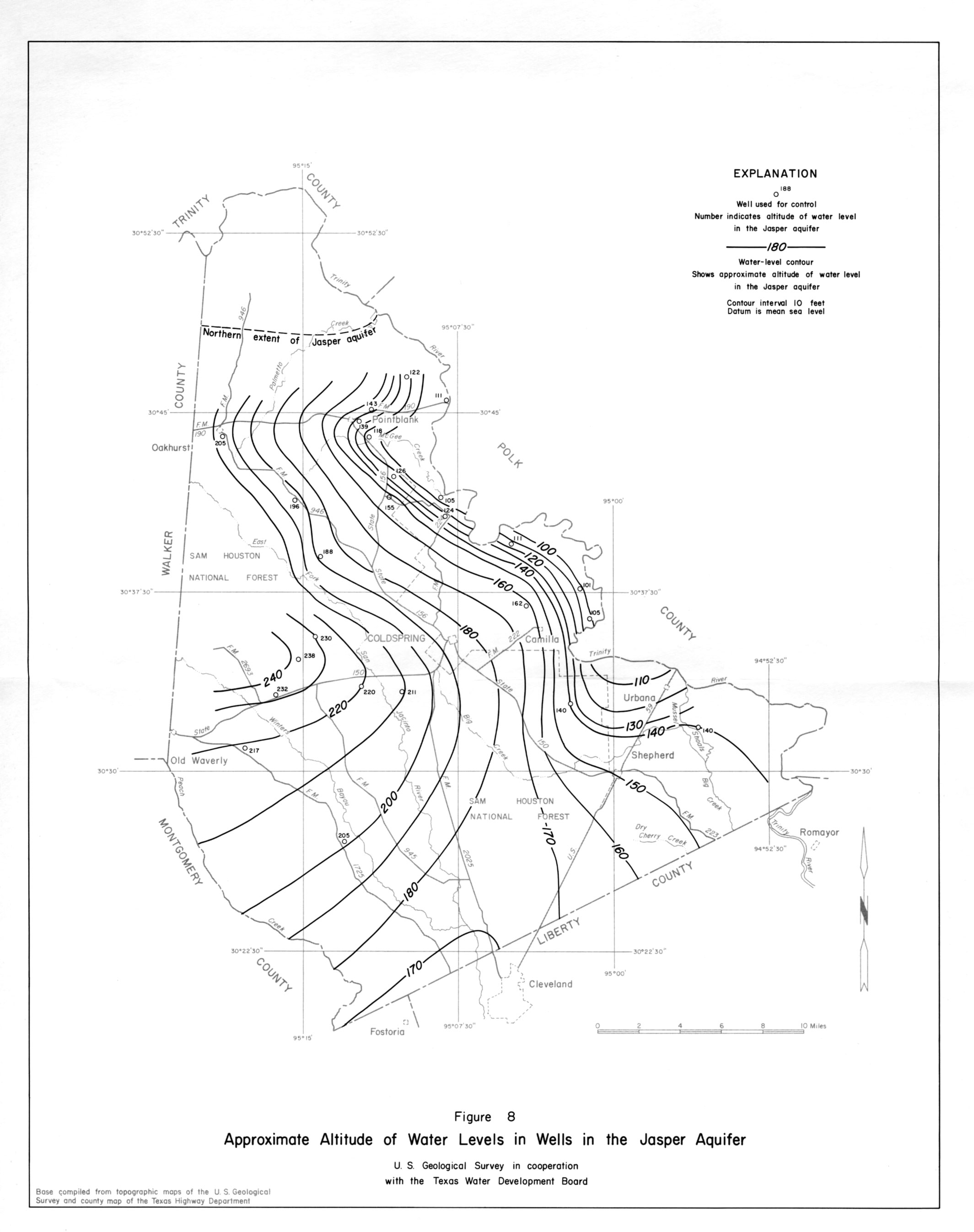
- figure 8 - Approximate Altitude of Water Levels in Wells in the Jasper Aquifer
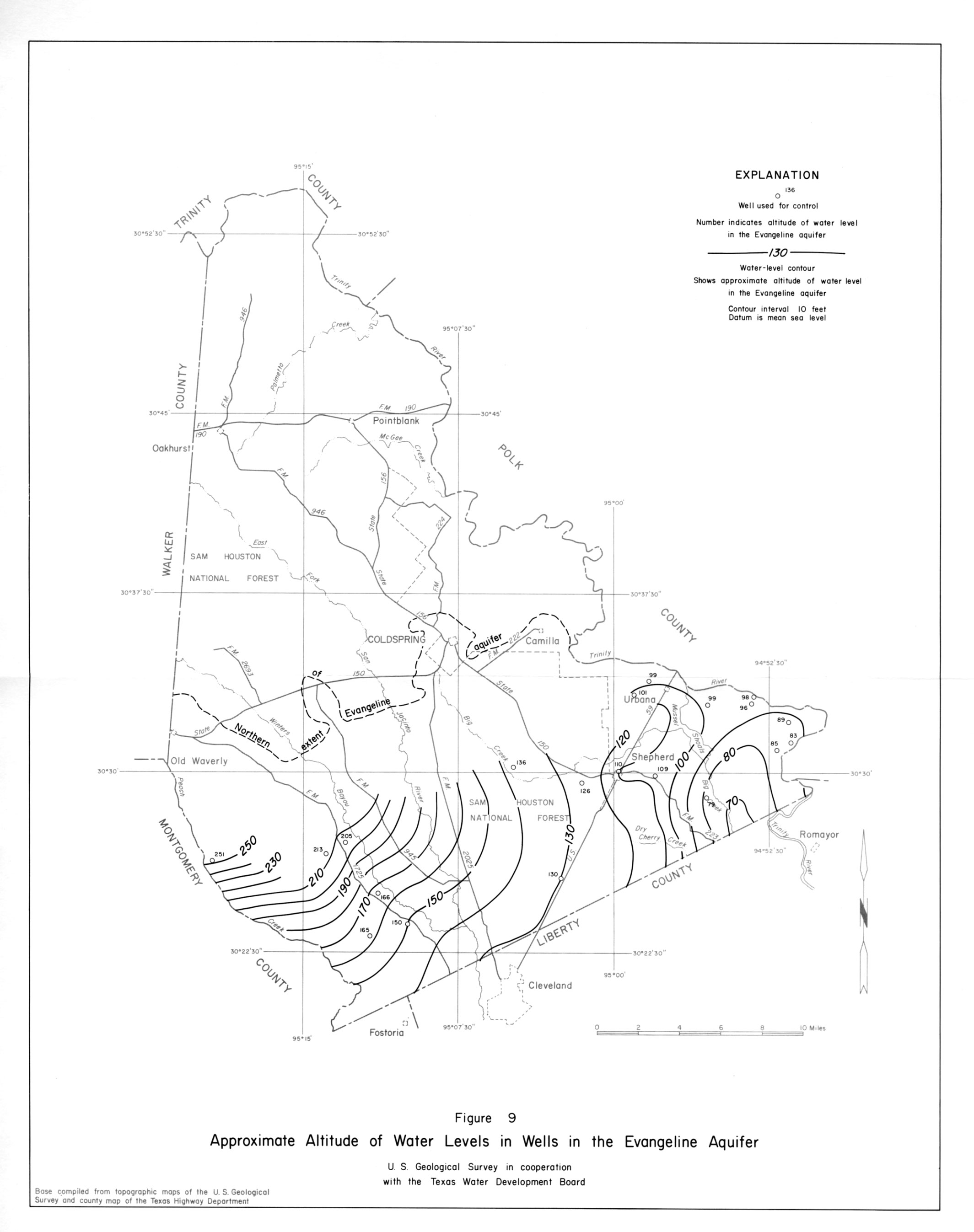
- figure 9 - Approximate Altitude of Water Levels in Wells in the Evangeline Aquifer
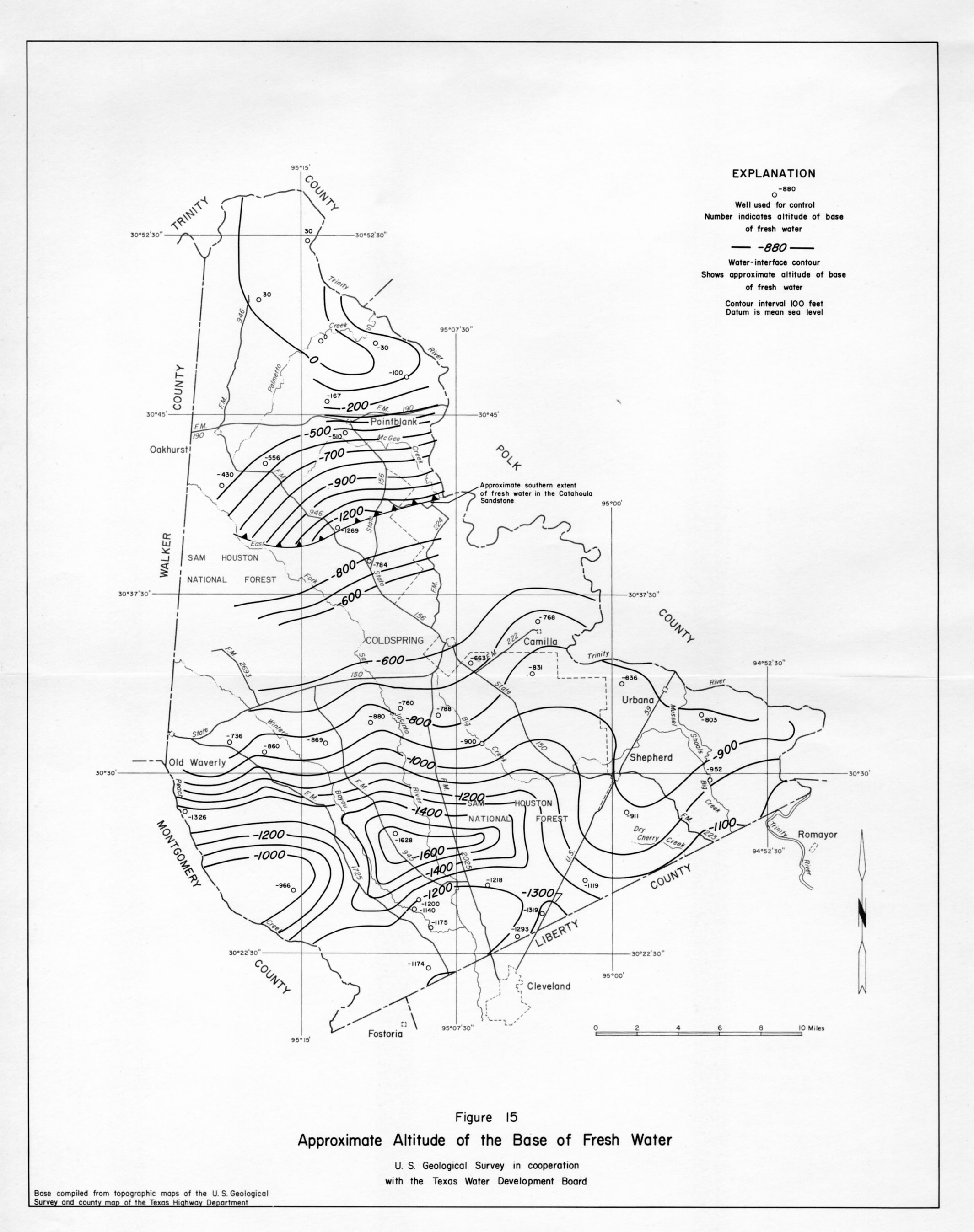
- figure 15 - Approximate Altitude of the Base of Fresh Water
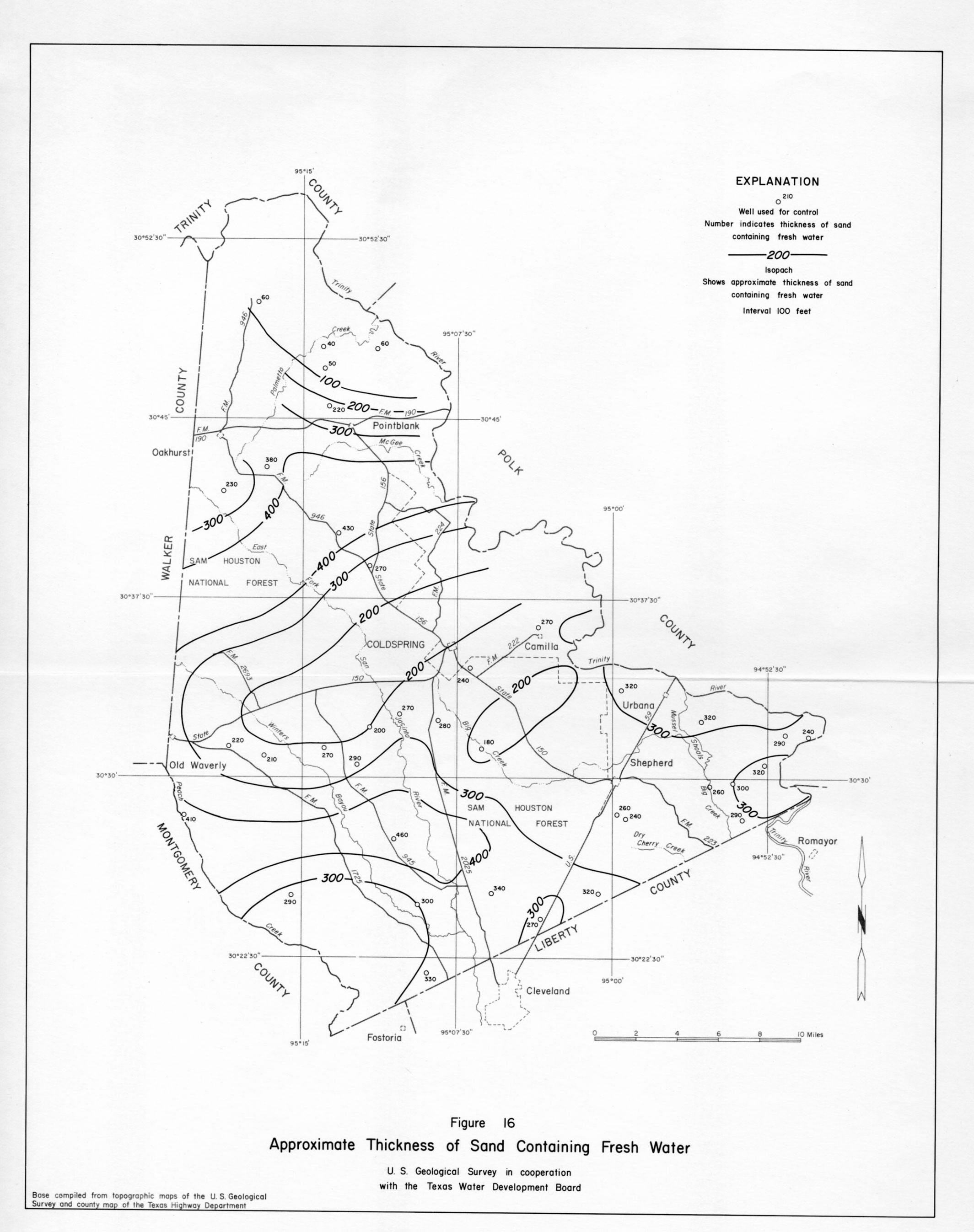
- figure 16 - Approximate Thickness of Sand Containing Fresh Water
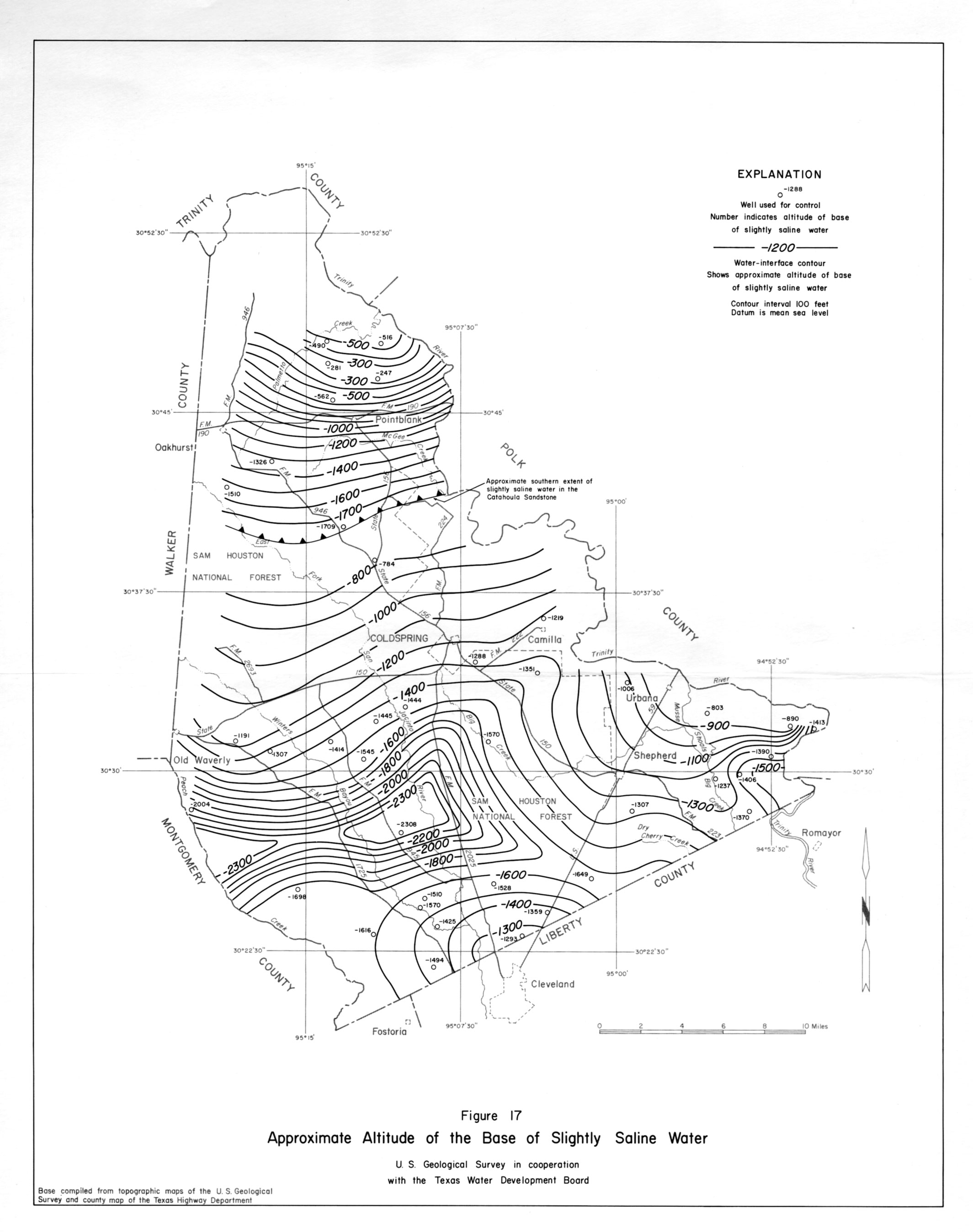
- figure 17 - Approximate Altitude of the Base of Slightly Saline Water
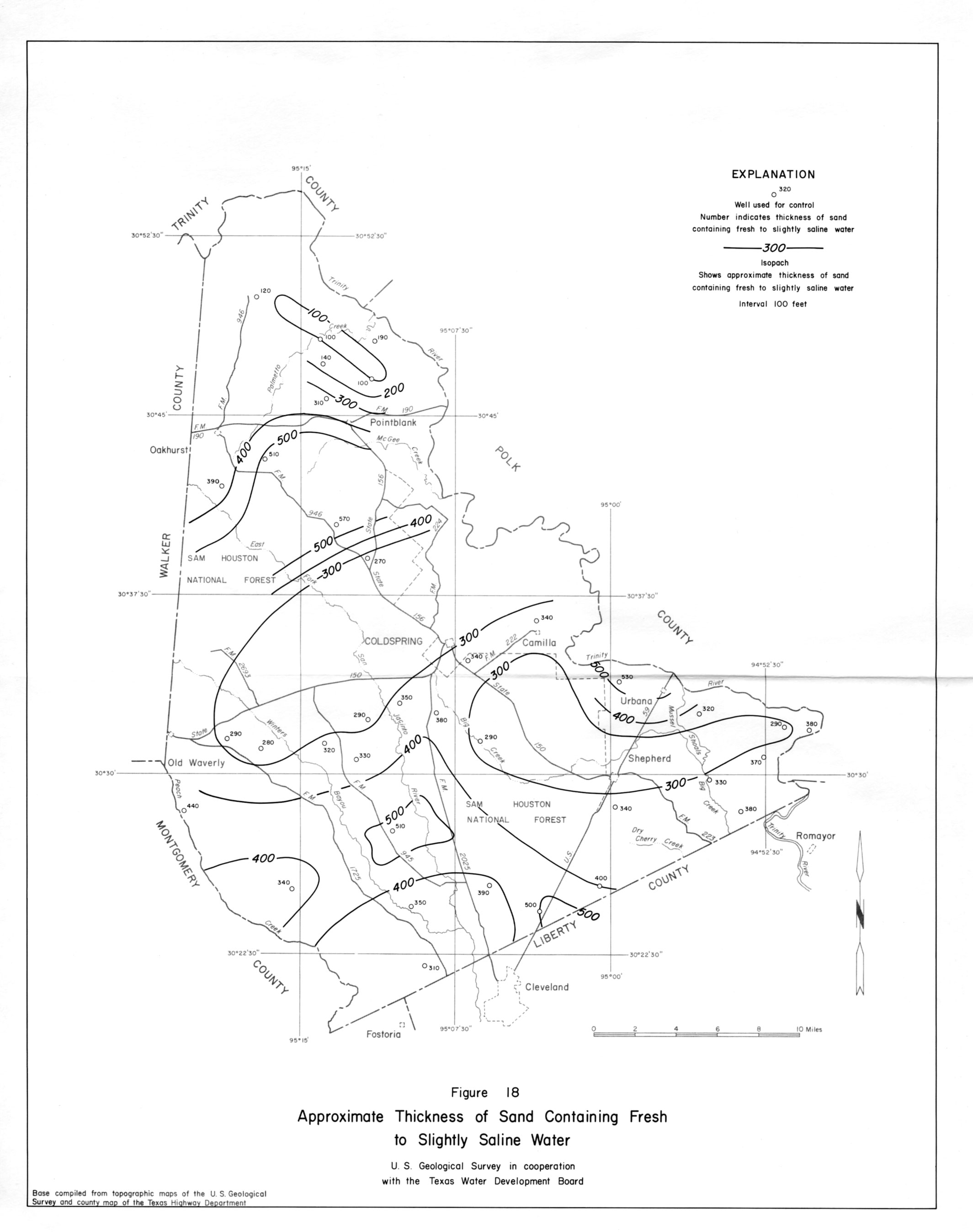
- figure 18 - Approximate Thickness of Sand Containing Fresh to Slightly Saline Water
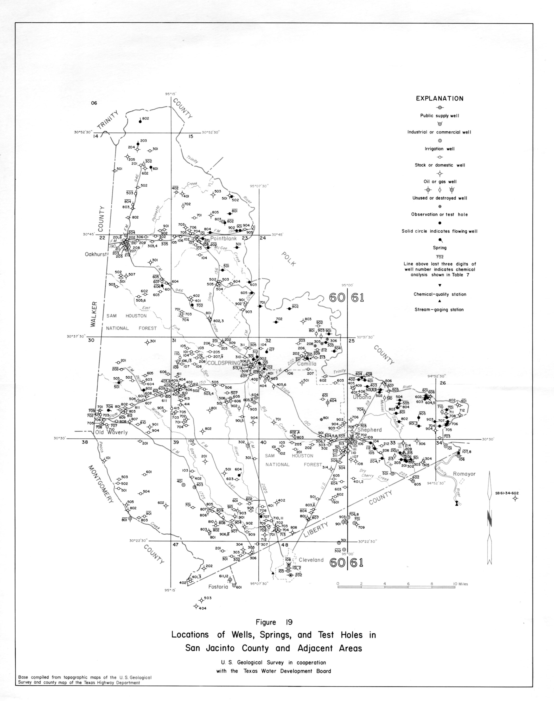
- figure 19 - Locations of Wells, Springs, and Test Holes in San Jacinto and Adjacent Counties
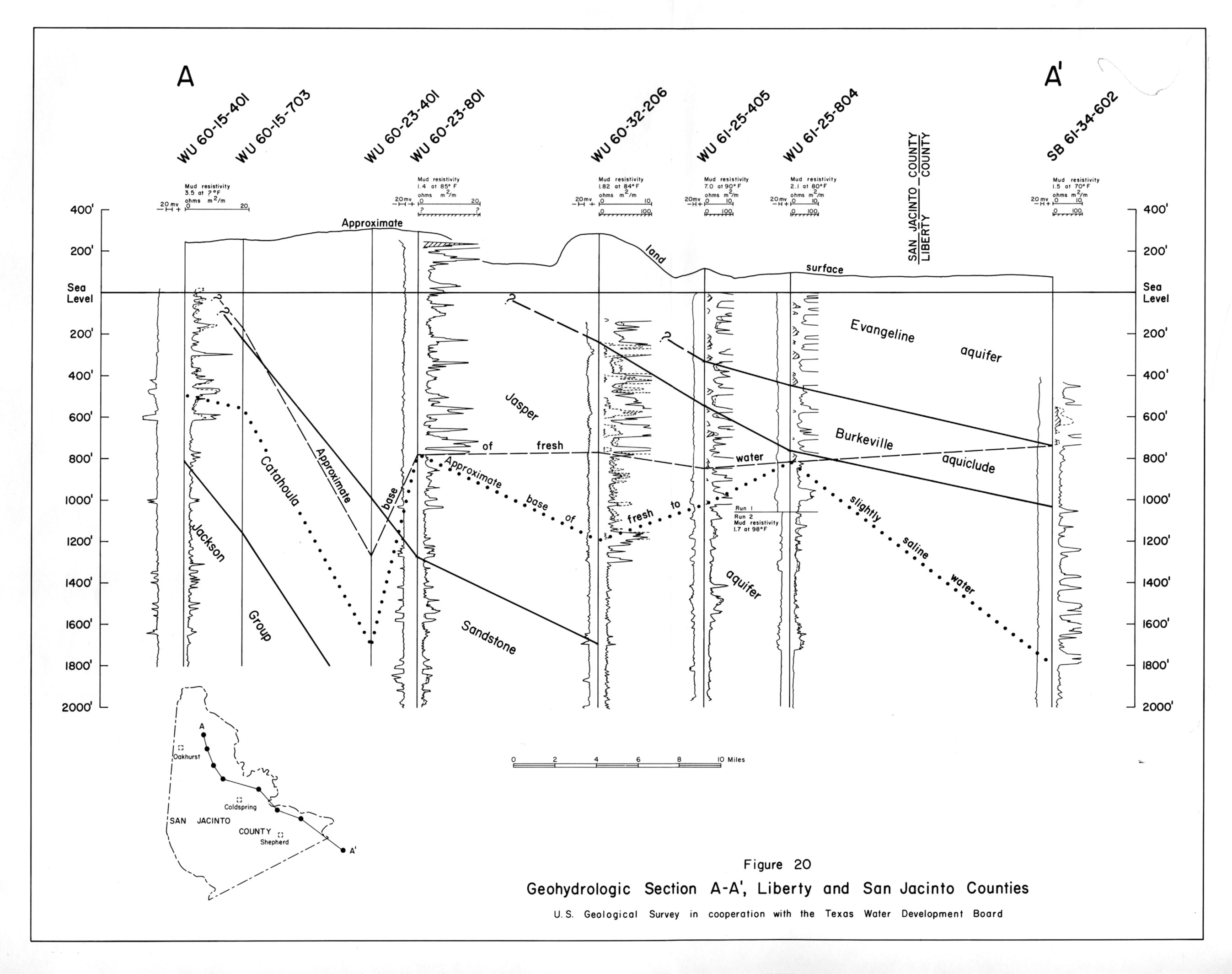
- figure 20 - Geohydrologic Section A-A,'Liberty and San Jacinto Counties
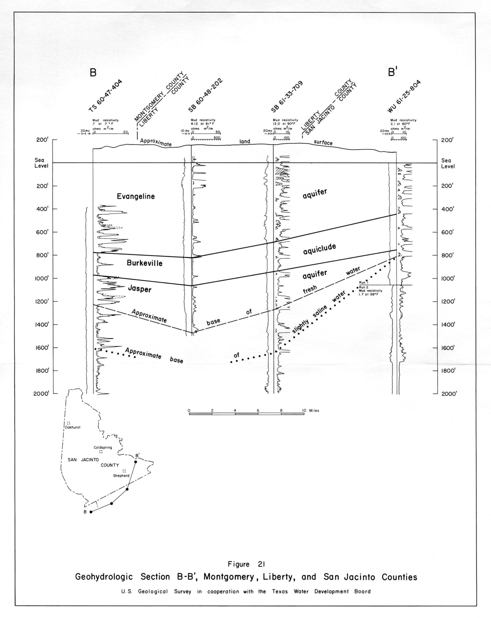
- figure 21 - Geohydrologic Section B-B,'Montgomery, Liberty and San Jacinto Counties